How does a warehouse robot know where to go?
Imagine an autonomous mobile robot (AMR) carrying a pallet from a staging bay to a production line. At the staging bay, localization tells the robot where it is on the site map and which way it is facing. In a shared aisle, path planning chooses a permitted route to the destination. At the production line, docking aligns the robot and its load with the receiving equipment.
- Locate at pickupMatch the robot to the map near the staging bay.
- Plan around trafficUse a permitted route, or wait if the aisle is blocked.
- Align at drop-offLine up with the actual conveyor or transfer fixture.
These functions can use different references. The map may locate the robot near the conveyor, while a camera observes a marker at the station to refine its final approach. A safety scanner may monitor the space around the vehicle while the planner evaluates an alternate route. If an aisle is too narrow to pass an obstruction, the vehicle may wait, stop or ask fleet control to reassign the job, depending on site rules and the system configuration.
This distinction also helps explain why a laser-equipped vehicle can still follow a predefined route. Its positioning system can tell it where it is while the site controller determines which route it may take. For the broader vehicle comparison, see our AMR vs AGV guide. A3 vehicle definitions · Nav2 documentation on planning and site rules
How did navigation move from floor wires to environmental maps?
| Stage | What the vehicle used | What changed for the operator |
|---|---|---|
| 1950s — buried wire | A sensor followed the electromagnetic signal from a wire in the floor. | A tug could repeat the same material movement along a physical guide path. Changing that path involved altering the floor installation. |
| 1980s — inertial and laser guidance | Inertial systems estimated motion and could use fixed reference points for correction. Laser systems could locate the vehicle against installed reflectors. | A vehicle could follow routes defined in software without needing a continuous wire under the whole route. |
| 2000s — floor-code grids | A downward-facing camera read markers at known locations. A fleet controller coordinated movements through a grid. | Many vehicles could share a structured layout and carry racks or inventory pods to workstations. |
| 2010s onward — natural features and sensor fusion | LiDAR or cameras used building features to create maps and estimate position. Encoders, inertial sensors and local references could assist. | More deployments could use the existing building as a reference. Site teams could change destinations or permitted routes in software, subject to mapping and validation. |
The stages overlap. Kiva's warehouse deployments showed how much a structured grid can achieve when the job is moving shelves to picking stations. SLAM, or simultaneous localization and mapping, describes how a robot builds a map while estimating its own position. Once a site map exists, the robot can use it as a reference during routine operations. The industry still uses floor codes, laser reflectors and map-based systems where each fits the work. Transbotics navigation history · Kiva engineering paper · ORB-SLAM research
How do LiDAR SLAM, visual SLAM and floor codes compare?
| Technology | What the robot reads | Where it helps | What to check at your site |
|---|---|---|---|
| LiDAR SLAM | Distances to surfaces such as walls, columns and rack ends. | Indoor routes with recognizable geometry, including areas with low visible light. Natural-contour systems can often use existing building features. | Long aisles that look alike, glass or reflective surfaces, and features that disappear when pallets or people block the scan. |
| Visual SLAM | Camera features such as edges, textures and recognizable structures. | Facilities where cameras can see distinctive details, including features above the main traffic area when the design uses them. | Light changes across shifts, glare, camera occlusion and areas with few visual features. |
| Floor codes | A camera reads a code installed at a known position. The vehicle can use odometry or inertial sensing between markers, depending on the model. | Structured grids, repeated routes and stations that benefit from a fixed reference. | Where codes must be installed, who replaces damaged labels and what happens when a pallet covers one. |
Laser reflector positioning is another option. A robot measures fixed reflectors whose locations are known. LiDAR SLAM estimates position using environmental features such as walls and columns. Ask the supplier which of these its specification means by laser navigation, and ask which parts of the installation must stay in place. SICK LiDAR localization · ABB visual SLAM · Indoor LiDAR and inertial positioning study
How does hybrid navigation work in practice?
Combine sensors on one vehicle
Consider a route that starts in a bright staging area, continues through identical rack aisles and ends at a conveyor. The integrator maps the route and tests what each sensor can observe along it. A fusion system can combine laser, camera and motion measurements into a position estimate. Other products offer selectable modes or use a local reference only in a defined zone. The supplier should be able to explain which modes your configuration supports and what the robot does when a measurement becomes unreliable.
At the conveyor, a precise final approach may use a local marker, a view of the station or a mechanical guide, depending on the equipment. Test that step with the actual payload and transfer fixture. Wheel slip or a pallet overhanging the deck makes a loaded run a better test than an empty demonstration.
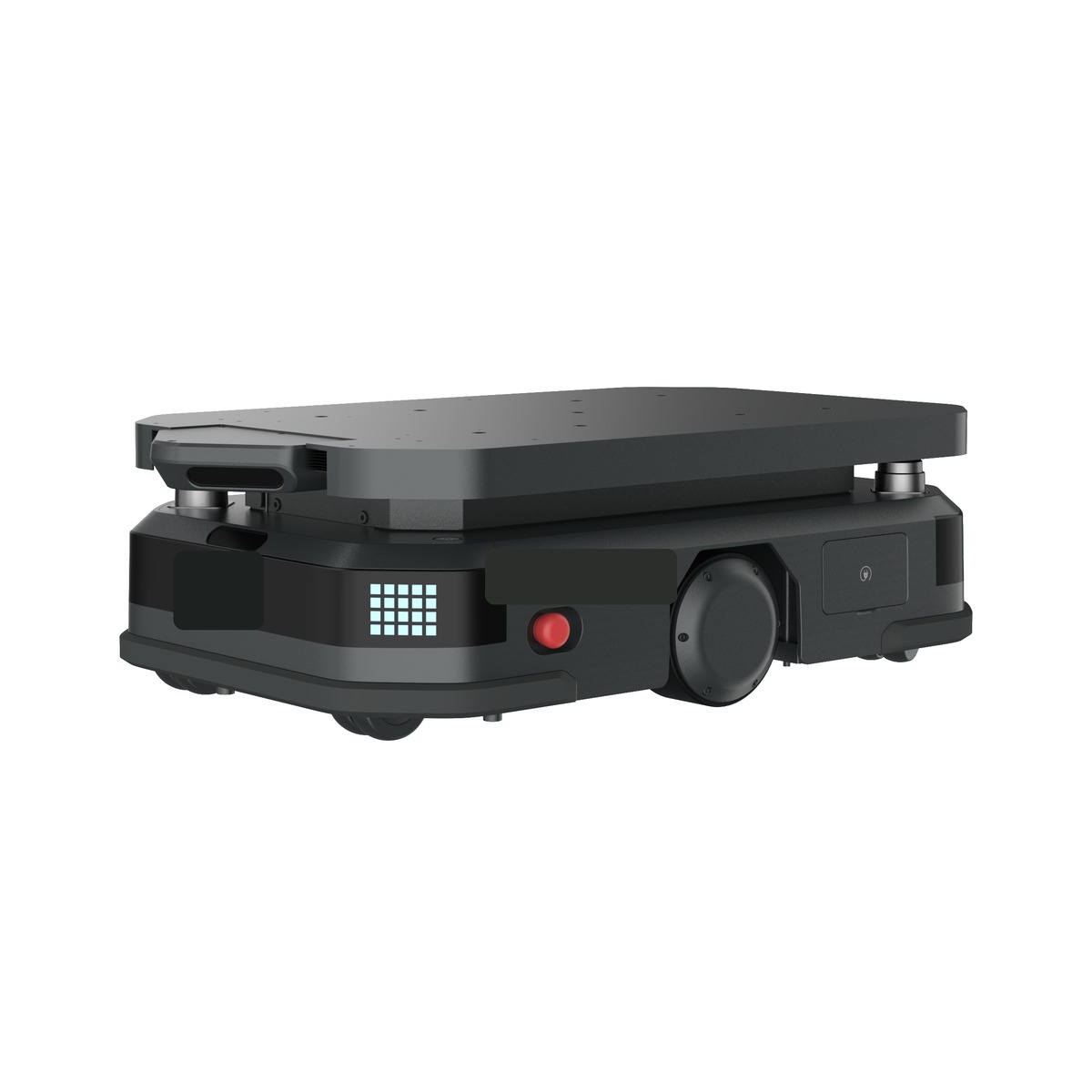
PanPanTech's 600 kg AMR-0600 has two configurations that illustrate the distinction. The mast configuration lists visual SLAM plus LiDAR SLAM. The underride configuration lists LiDAR SLAM. Both have the same rated payload. Compare them against the required load interface, approach clearance and the places where each configuration can see useful features. PanPanTech AMR-0600 specifications · SICK fixed-path travel and precise station positioning

Share work between an AGV and an AMR
A fixed-route automated guided vehicle (AGV) can keep a production line supplied on a repeatable loop, with AMRs serving multiple request points elsewhere in the same building. Both can drop at a shared buffer, provided the job logic knows who owns the position and when it is free. At shared intersections, lifts or narrow aisles, define who takes priority and where a waiting vehicle can stop without blocking the next job.
If the fleets come from different vendors, agree on task assignment, position reporting, shared-zone reservations and fault recovery before full deployment. VDA 5050 defines a communication interface between mobile robots and central fleet control. Ask which version and functions each supplier implements, then demonstrate the shared handoff and traffic behavior with the actual vehicles. VDA 5050 specification and scope
Is UWB still used for AMR localization?
Yes. Ultra-wideband uses radio measurements between a tag and fixed anchors at known locations to estimate position. A warehouse may use the same real-time location system to track robots, forklifts or tagged assets. If the controller supports it, UWB measurements can also provide an additional reference for the robot's onboard position estimate.
Continental and KINEXON publicly described UWB as a way to connect AMRs and other logistics objects to a location and management system. In a separate 2026 research demonstration, researchers fused UWB measurements with onboard motion sensing on a commercial logistics AMR. Those examples cover two different jobs: locating objects for operations and feeding measurements into vehicle localization. Continental and KINEXON deployment description · 2026 industrial AMR research demonstration
Consider UWB when a site already has suitable anchor coverage or needs a location system for both moving equipment and assets. Budget for mounting and surveying the anchors, power or network connections where required, and checking coverage in loaded aisles. Metal racks and stored goods can obstruct or reflect radio signals. Ask the integrator to show how the vehicle handles a poor reading or a coverage gap. Keep obstacle detection and final docking as separate items in the trial. UWB positioning under obstructed conditions
Which approach fits your warehouse?
- Fixed production loop. Start with the route, stop positions and required cycle time. If pickup points rarely move and the site can accommodate markers, guided travel is a practical candidate. Test how a blocked lane affects the work queue and how quickly staff can resume service.
- Warehouse with changing routes or shared aisles. Start with a map-based AMR trial on the busiest representative route. Use the actual traffic patterns and storage conditions. Compare how long it takes to change a station or validate a new route, and which changes require remapping.
- Tight transfer tolerances. Define the acceptance range for side-to-side error, approach angle and handoff height first. Ask for repeated loaded cycles at the exact station. Measure travel performance separately from docking repeatability.
Compare installation and operating costs at the site. Count time spent surveying markers, creating or updating maps, integrating fleet rules, maintaining references and recovering failed jobs. If a supplier quotes localization accuracy, ask where and under what conditions it was measured. For the conveyor or pallet rack, ask what fraction of loaded transfers completed without a second approach or operator assistance.
Representative systems to compare
| Project type | Representative examples |
|---|---|
| Structured or guided material flow | Quicktron M5E documents QR code plus inertial navigation. Geek+ M Series lists floor-code and laser SLAM options across the series. E80 Group LGVs show how laser-guided pallet transport can be integrated into a plant or distribution center. |
| Map-based navigation | MiR documents laser-based mapping. ABB offers visual SLAM for industrial AMRs. Seegrid describes combining LiDAR and stereo cameras in its autonomous material handling products. |
What should you test before buying?
Run the same route on each shortlisted configuration with a representative load. Agree on the route, traffic rules and transfer tolerances before collecting results.
| Trial | What to record |
|---|---|
| Normal operation across shifts | Completed moves per hour, typical and slow cycle times, and how often a person intervenes. |
| Temporarily blocked aisle | Whether the vehicle waits, takes a permitted alternate route or requests help. Record recovery time and the effect on other jobs. |
| Changed surroundings | After an approved layout change or during different lighting conditions, record failed localization attempts, recovery time and any edits the map or markers need. |
| Repeated loaded docking | Number of attempts, successful first approaches, positional and angular error, and manual corrections. Include the actual pallet or rack variations. |
| Shared traffic or localization fault | In a controlled test agreed with the integrator, verify intersection priority, safe stopping and how the unfinished job is recovered. |
A short test on the hardest representative route tells you which features matter for your operation. Bring a route sketch, the peak-shift traffic pattern and the receiving station tolerances to the first site review. PanPanTech warehouse and logistics robots